For mountain bike clubs, anywhere
Track trail conditions and maintenance — together
We're a community dedicated to a simple truth: the best trails are the ones we build and maintain together. By providing a quick and easy way to report issues, Open Trail helps us all contribute to a collective effort that keeps our trail networks thriving. Join us and become a part of the crew that makes a difference, one trail at a time.
Wherever you ride
One app. Any trail network.
OpenTrail started on the singletrack around Beechworth, Victoria — but nothing about it is tied to one place. Every trail, report and working bee sits on top of OpenStreetMap's open trail data, the same map data volunteers maintain for mountain bike networks everywhere. Point it at your own trailhead and it just works.
Beechworth, VIC — granite and native eucalypt wonderland
Rotorua, NZ — volcanic loam paradise
Squamish, BC — slab-riding and loam capital
Different dirt, different climate, different club — same app, same open map data, your trails.
From report to repair
From rutted-out to ridden again
Every report follows the same path, whether it lands in Beechworth or on your local loop.
Spot it
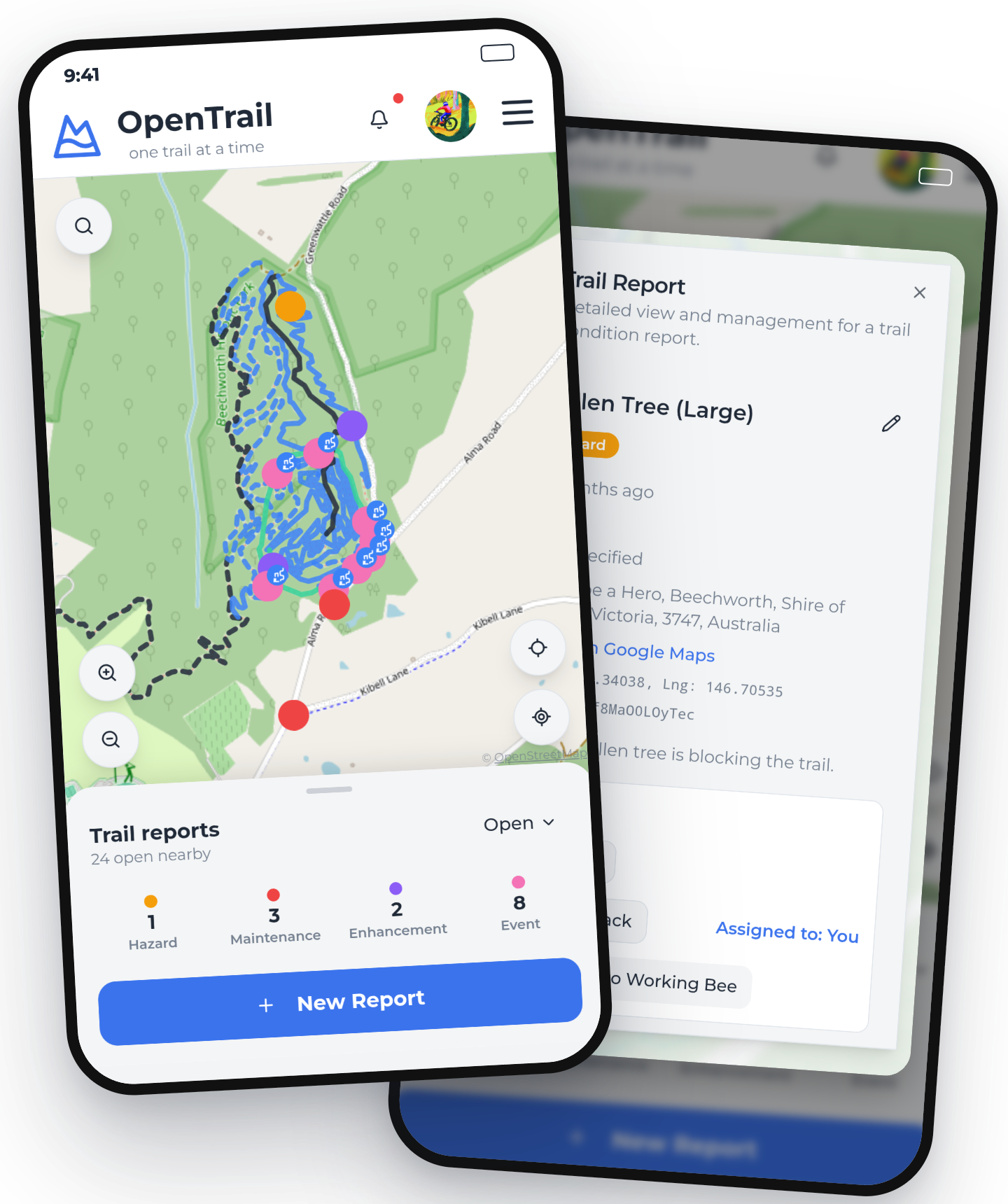
See a fallen tree or hazard? Drop a pin on the live map from wherever you're standing.
Report it
Snap a photo and OpenTrail's AI drafts the report for you — issue type, description, exact location — in seconds.
Triage
Your local trail crew gets the notification and works out what's actually needed to fix it — and how urgently.
Rally the crew
Sort it as a one-off fix, or group it with other reports into your next working bee — your club's scheduled trail care day — so volunteers know exactly what to bring tools for.
Ride it again
Once it's fixed, the report closes and the hours get logged to your club's history.
Legend
What's on the map
Read it the way you'd read the board at the trailhead.
Live trail map
Pulled straight from OpenStreetMap and graded by difficulty — the same green circle, blue square and black-diamond colours painted on trailhead signs.
Issue reports
Hazards, maintenance, enhancements and events — colour-coded so your club can triage at a glance.
Working bees
Scheduled volunteer maintenance days, with hours logged and reports closed in bulk once the crew's done.
Watchlist
Follow a trailhead or suburb and get notified the moment a new report lands nearby.